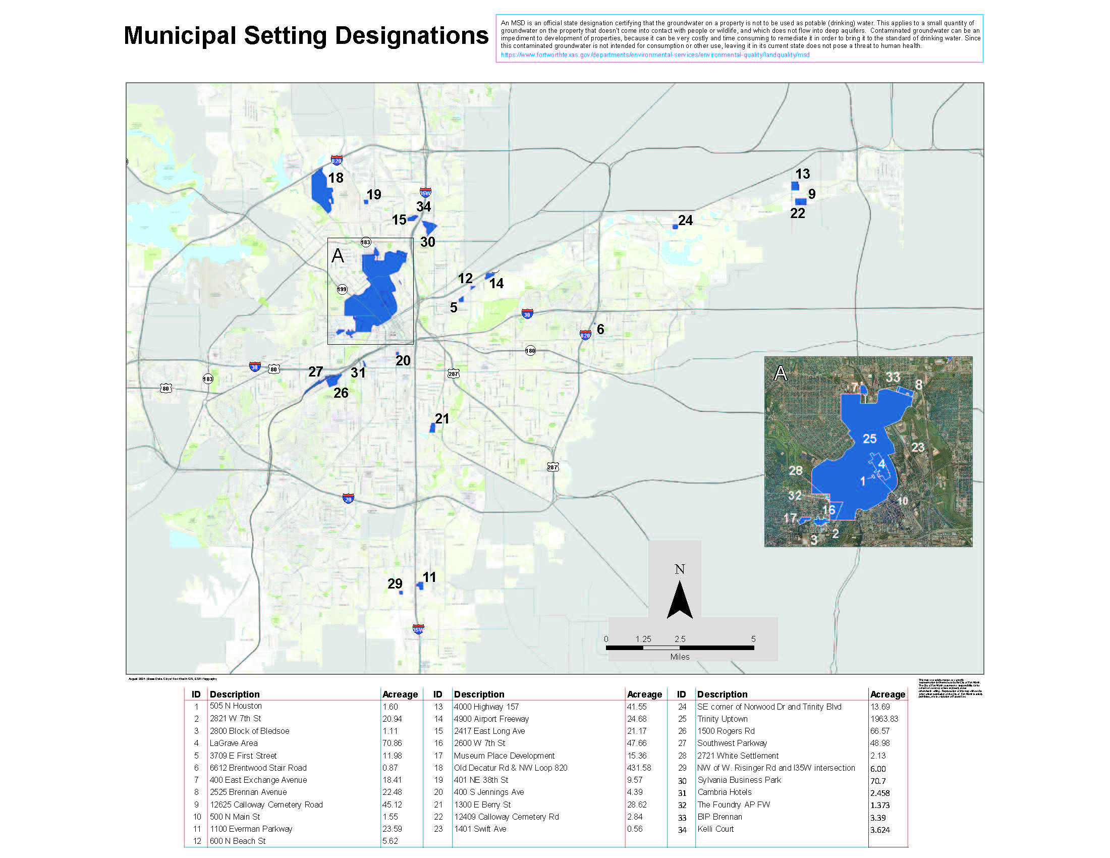
A Municipal Setting Designation (MSD) is an official state designation that certifies that a property’s groundwater will never be used as potable (drinking) water. This designation is for small amounts of groundwater that do not have contact with people or wildlife and do not flow into deep aquifers. The City of Fort Worth Municipal Setting Designation (MSD) Application fee was enacted by Ordinance No. 16259-01-2005 in January 2005.
 |
|
This map was solely created as a graphic representation for internal use by the City of Fort Worth. The City of Fort Worth assumes no responsibility for its content or accuracy unless expressly stated otherwise in writing. Reproduction of this map without the prior written permission of the City of Fort Worth is strictly prohibited, and is in violation of Federal law.
|
| Download MSD Map(PDF, 4MB) View GIS Data |
Why do we need MSDs?
Contaminated groundwater can be an impediment to development of properties, because it can be very costly and time consuming to remediate it in order to bring it to the standard of drinking water. Since this contaminated groundwater is not intended for consumption or other use, leaving it in its current state does not pose a threat to human health.
The City of Fort Worth MSD Program
As per state requirement, a Municipal Settings Designation is established when City Council adopts a resolution and an ordinance to prohibit the use of identified groundwater as potable water.
Apply for an MSD
Starting October 1, 2024, the MSD Application fee will be $7,500. This fee covers associated costs for administrative review, meeting coordination, public notification, printing, mailing, and approval for an individual MSD application.
Overview & Guidelines(PDF, 227KB)
Application(PDF, 184KB)